
Volunteer on October 20, 2018
Join us for Stream Monitoring – macroinvertebrate sampling – on Saturday, October 20th. (NOTE: New Date October 20th)
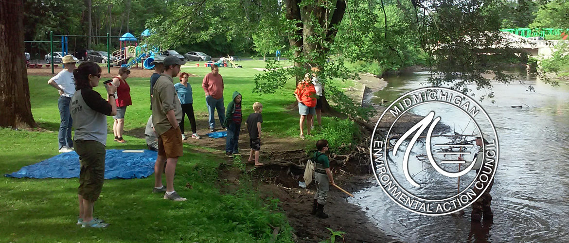
We meet at Ferguson Park (map) in Okemos, at 9am for a brief training session. MidMEAC provides waders, nets, and materials to sort and preserve the samples.
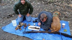
Volunteers sample in teams. At least one person will sample from within the stream, other team member(s) sort through the sampled material.
Thanks to MidMEAC Vice President David Christian, P.E., for leading MidMEAC Stream Monitoring.
About MidMEAC Stream Monitoring
Each spring and fall, a well-trained team of MidMEAC Volunteer Stream Monitors puts on waders and heads into the streams of the Red Cedar River watershed to search for bugs and other river “critters.” Using nets to collect the bugs from the streams, and trays and tweezers to sort through them on shore, these stream monitors are an integral part of the protection of the Red Cedar River and its tributaries. MidMEAC has lead this initiative for more than ten years.
The types of bugs (also known as macroinvertebrates) that they collect tell a story about the health of the river at each location. Some bugs are very sensitive to pollution or disturbance to the stream, and they will disappear if the stream becomes degraded. MidMEAC has been conducting this program for 1996. The results have been used to develop remediation plans and were cited in the Red Cedar River Watershed Management Plan.
We need volunteers to help with our Fall and Spring monitoring sessions. Each session takes less than one (weekend) day with training provided. Those who wish to participate in bug identification are welcome to return for an additional part-day session.
 MidMEAC Volunteer Stream Monitoring Sites
Maps, images, and stream scores of our 12 Monitoring Sites can be viewed here.
Become a Stream Monitoring Volunteer
To become part of MidMEAC’s Volunteer Stream Monitoring Program, RSVP on Facebook or contact our Volunteer Stream Monitoring Coordinator at 517.292.3078 or via email us.
Program Goals
The ultimate goal of this program is to create swimmable, fishable streams and rivers in Mid-Michigan. MidMEAC’s volunteer stream monitoring program is one strategy within that goal, which fits into MidMEAC’s mission of helping people transform environmental concerns into action. Not only does the program allow us to collect data which can then be used in the future for advocacy efforts and river protection efforts, it also helps people connect with, appreciate, and understand our local waterways. Goals: Improve water quality in the Red Cedar River Watershed; Improve awareness of water quality issues facing the Red Cedar Watershed; and Increase level of community and individual commitment to water quality stewardship
How MidMEAC Uses the Data
Data results are communicated to the public, the MDEQ, and the Greater Lansing Regional Committee for Stormwater Management after each collection session. The data is also entered into the MiCorps exchange database, a statewide system for volunteer stream monitoring data, and entered into charts and graphs that illustrate the trends and findings. As problem areas are identified within the watershed, MidMEAC will work with community partners and land owners to develop solutions to alleviate conditions that create negative impacts on overall stream health.
Volunteer Stream Monitoring Training Materials
Team Structure & Collection Technique – explains procedures and techniques to use on collection days.
Macroinvertebrate Datasheet – Page 1 of this sheet is filled out at the stream; Page 2 is filled out on Identification Day.
Stream Habitat Definitions – explains the terms on the datasheet and on the Collection Techniques handout.
Pictures of Bugs – shows the types of critters you’ll be collecting.
Michigan Clean Water Corp (Mi-Corps) Volunteer Stream Monitoring Procedures – link
State of the Red Cedar Report
MidMEAC is pleased to present the 2015 State of the Red Cedar Report which includes all data collected by our volunteers during the 2015 sampling season. Please note that, while this report provides a good overview of the condition of the Red Cedar Watershed, it is not the only source of information to be considered when evaluating a waterway or watershed.
View the 2014 Report
Want to know more about our watershed? Check out the Greater Lansing Committee for Stormwater Management.
MDNR Inland Lake Habitat Map
Michigan’s 11,000 inland lakes are incredibly diverse and vary in depth, productivity, thermal stratification, oxygen, alkalinity, shoreline armoring, docks, woody habitat, housing density and other characteristics. MDNR has developed an online interactive map to help those interested in learning more about lake habitats. Find it here.