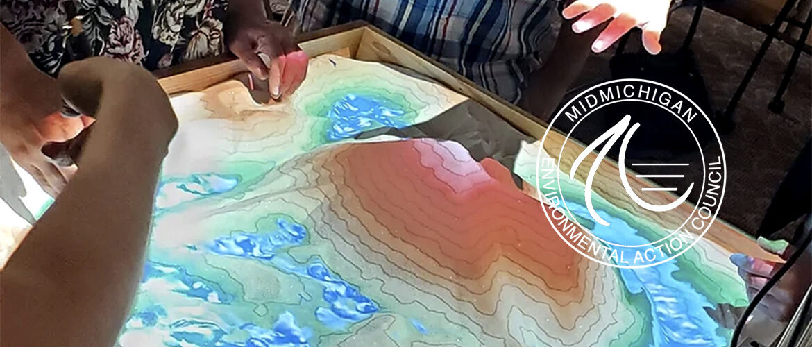
The augmented reality sandbox (ARS) is a 3D, interactive, dynamic educational tool to help understand mapping, topography, watersheds, natural hazards, and human impact upon our environment. The ARS allows users to create topographic models by shaping real sand, which is then augmented in real time by an elevation color map, topographic contour lines, and simulated water. The system teaches geographical, geological, and hydrological concepts such as how to read a topography map and the meaning of contour lines, watersheds, and catchment areas.
ARS Project Partners include:
 |
 |
 |
 |
 |
 |
Eaton Conservation District visit site
Greater Lansing Regional Committee for Stormwater Management more about ARS More about GLRC visit site
Michigan Watershed Stewardship Program, from the Michigan Department of Agriculture and Rural Development visit site
MidMichigan Environmental Action Council Request a demonstration
National Oceanic and Atmospheric Administration
Tri County Regional Planning Commission